Director, MK Surveys
Lewis Hook BSc (Hons) MCInstCES MRICS,

Working as: Land Surveyor, Maltby Land Surveys
After 10 years in surveying – 8 of them with Maltby Land Surveys – no two weeks are ever the same. Here’s a quick look at one spring week in 2024, when a colleague’s unfortunate footballing injury meant we all picked up a little extra…
Helping a family split their farm for sale.
Walk the site, plan the traverse, set up five stations, pick up all boundary features, GPS the lot, photograph everything, then back to the office for processing in LSS and AutoCAD. Finish the day drawing up the new deed boundary.

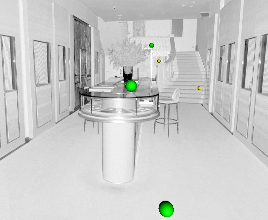
4:45am start for a high-end jeweller’s in London.
Scan front and rear elevations plus six floors before the doors open. GPS struggles between skyscrapers, fire escapes for rear access, and lots of fast, tidy scanning. Back to the office to register the scans, set control and prep for the next job.
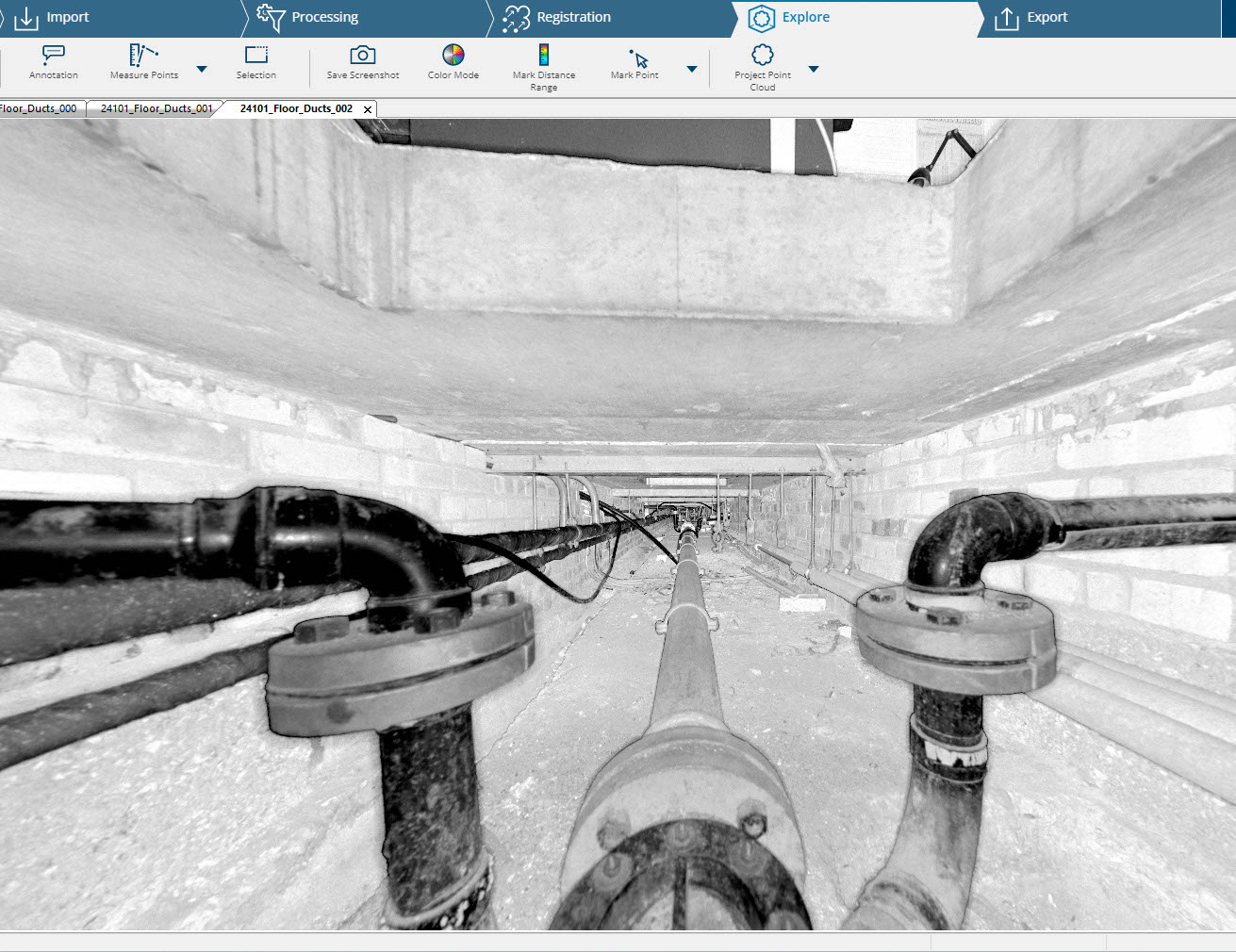
Industrial workshop needing accurate duct positions before installing heavy kit.
Using old scans via Faro Webshare, we scanned at eye level, then lowered the scanner to floor level and finally into the ducts – carefully. Repeat across the site. Afternoon spent registering everything and stitching it to the previous survey.
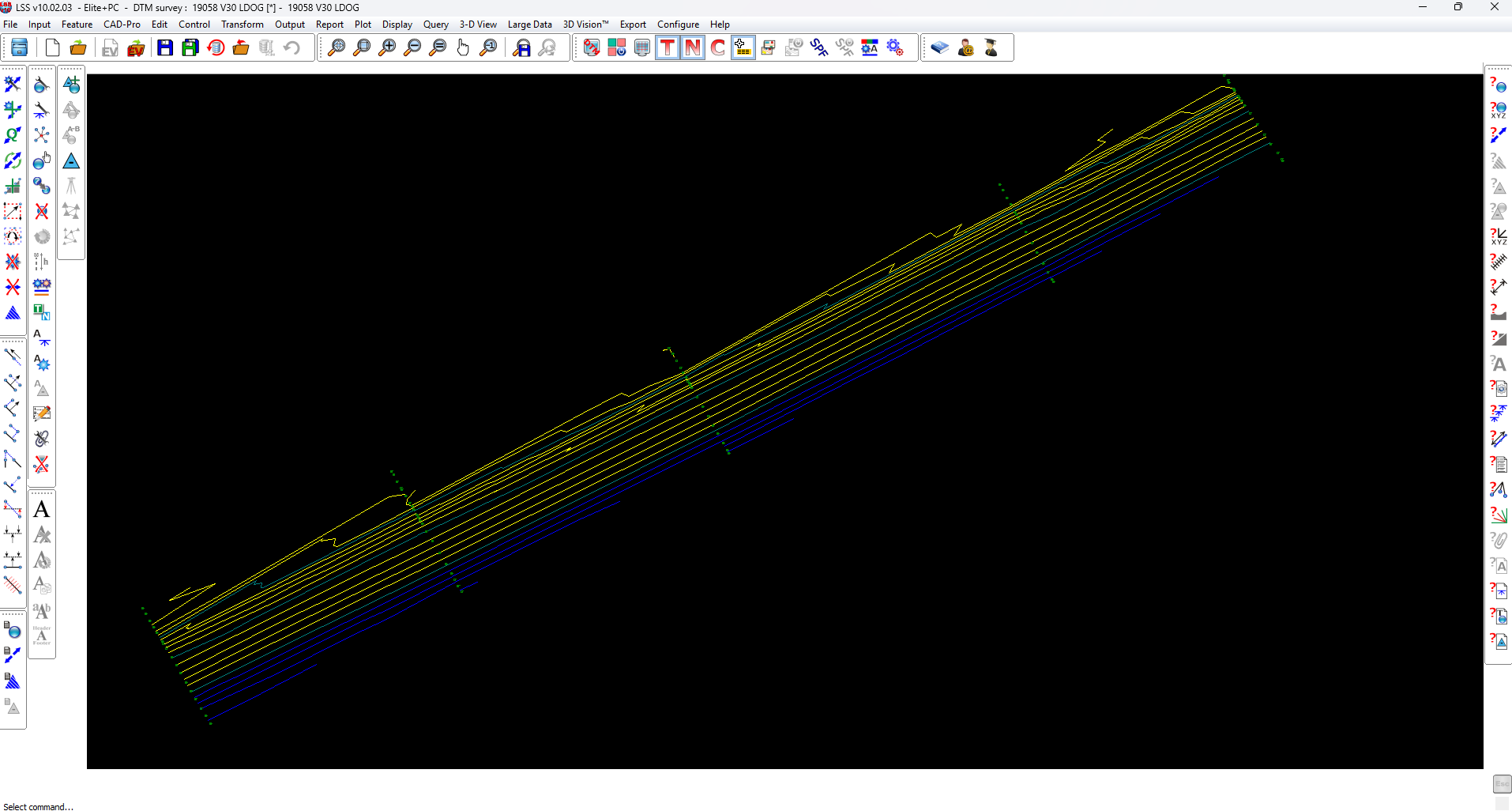
Low tide waits for nobody.
On site before sunrise, walking 10km of shingle with GPS units, picking up profiles every ~200m down to -2.00m. Race the tide, grab the data, then back to the office to build tidy profile spreadsheets for comparison.
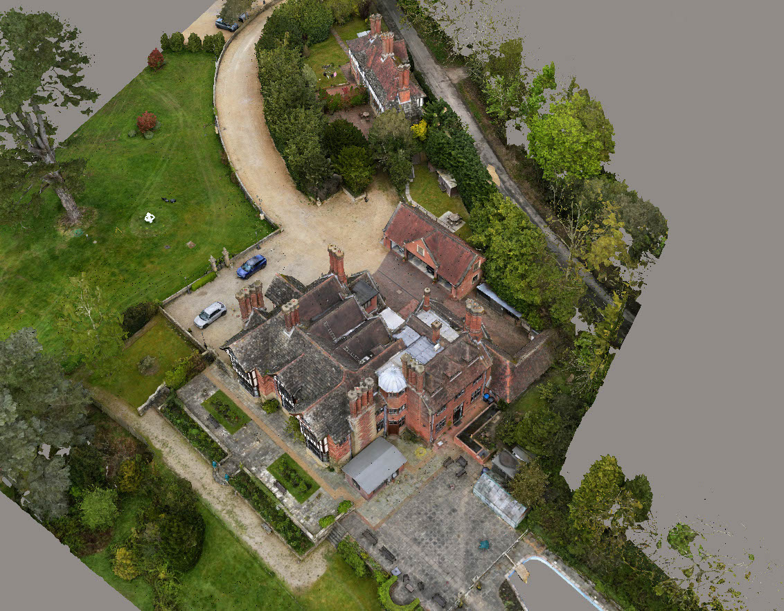
Five-person team tackling elevations, floor plans, drone roof capture, and garden topo.
Two on scanners, one on drone, two of us walking a 10-station traverse loop with GPS checks and level runs. Hundreds of topo points, tricky level changes, manicured gardens, AP20 doing its magic. Finish the week downloading data from every instrument under the sun.
Next week: office time… hopefully!